

Open Space
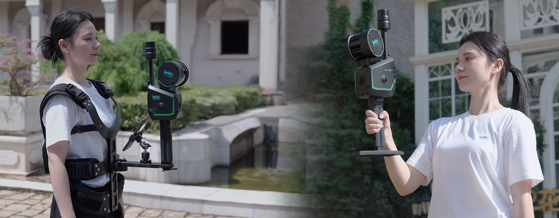
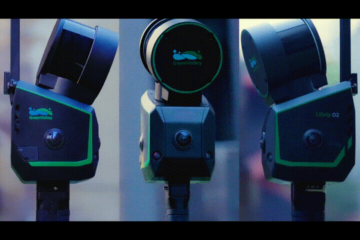
LiGrip O2
Flagship Handheld SLAM LiDAR Scanner
LiGrip O2 is the next-generation flagship handheld SLAM LiDAR scanner developed by GreenValley International. This all-in-one device integrates LiDAR, panoramic cameras, visual SLAM cameras, and a GNSS antenna, enabling high-precision, all-directional data acquisition without limitations of time or environment.
Weight
2.2 kg
Absolute Accuracy
< 3 cm
LiDAR Scan Rate
Up to 640,000 pts/s
Max Detection Range
300 m
Panoramic Camera
12 MP ×3
VSLAM Camera
1.3 MP ×2
FOV
280° × 360°
Storage Capacity
512 GB SSD
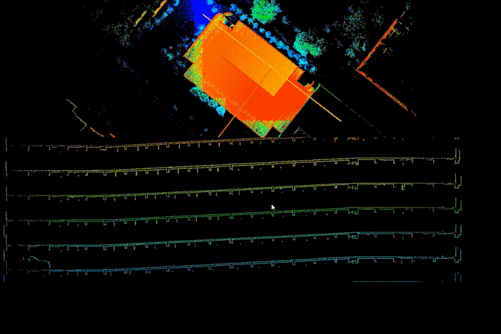
RTK - SLAM vs MLF - SLAM
Designed for open and featureless environments, MLF-SLAM combines multiple localization sources to achieve absolute positioning with centimeter-level accuracy. Whether on highways, beaches, or bridges where GNSS is weak or unavailable, MLF-SLAM ensures stable trajectories, consistent point clouds, and reliable mapping results.
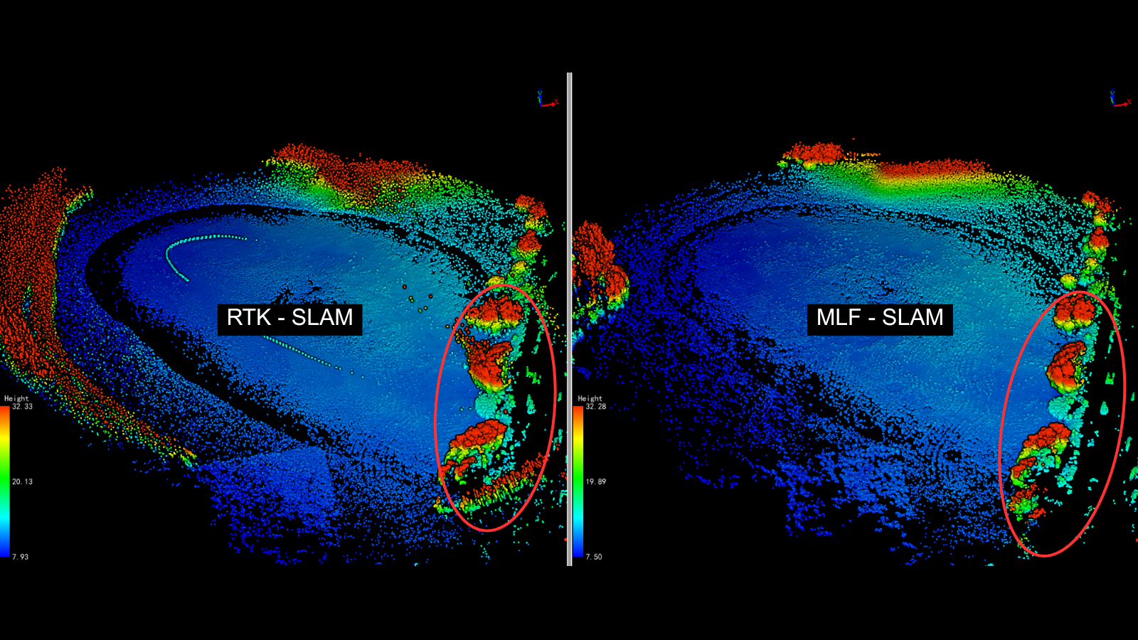
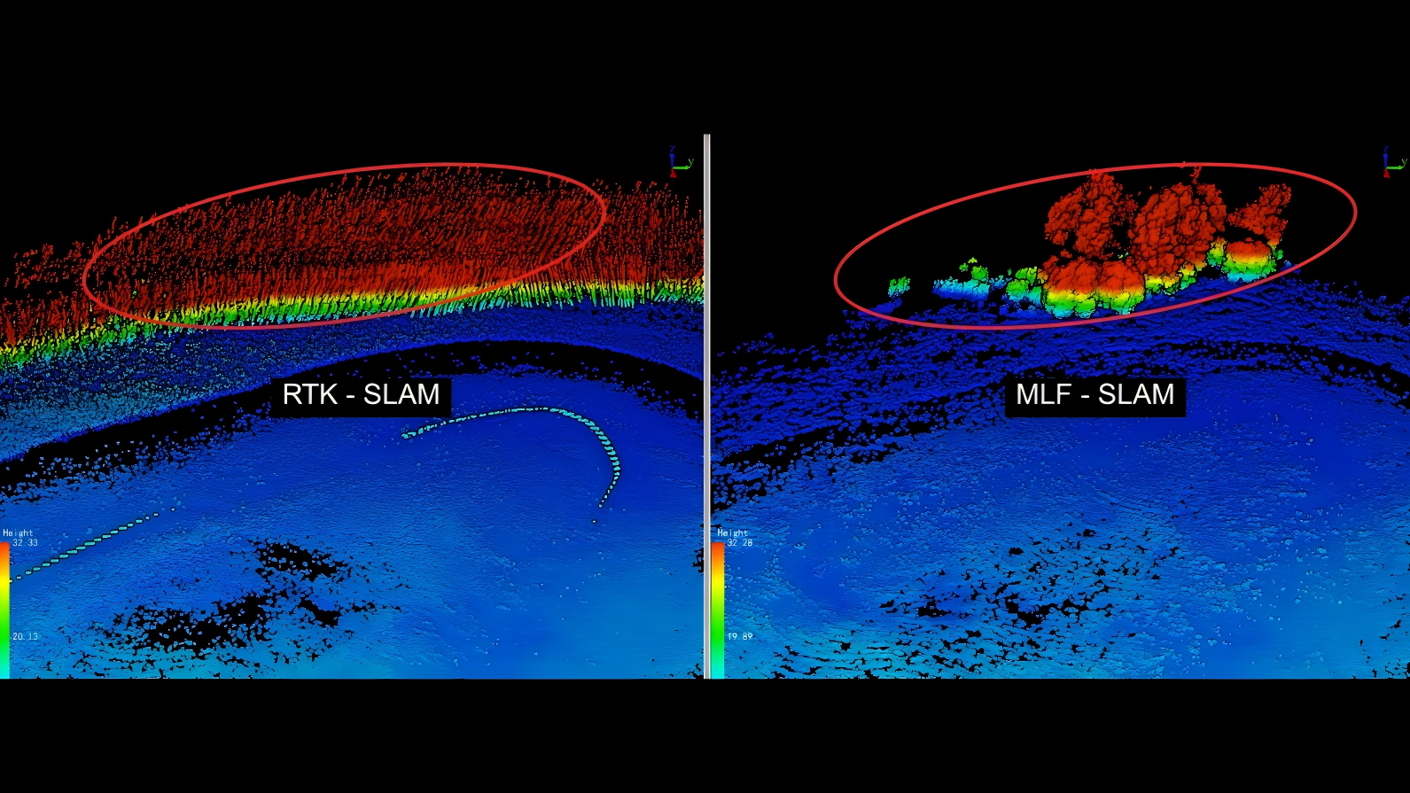
Open Lake
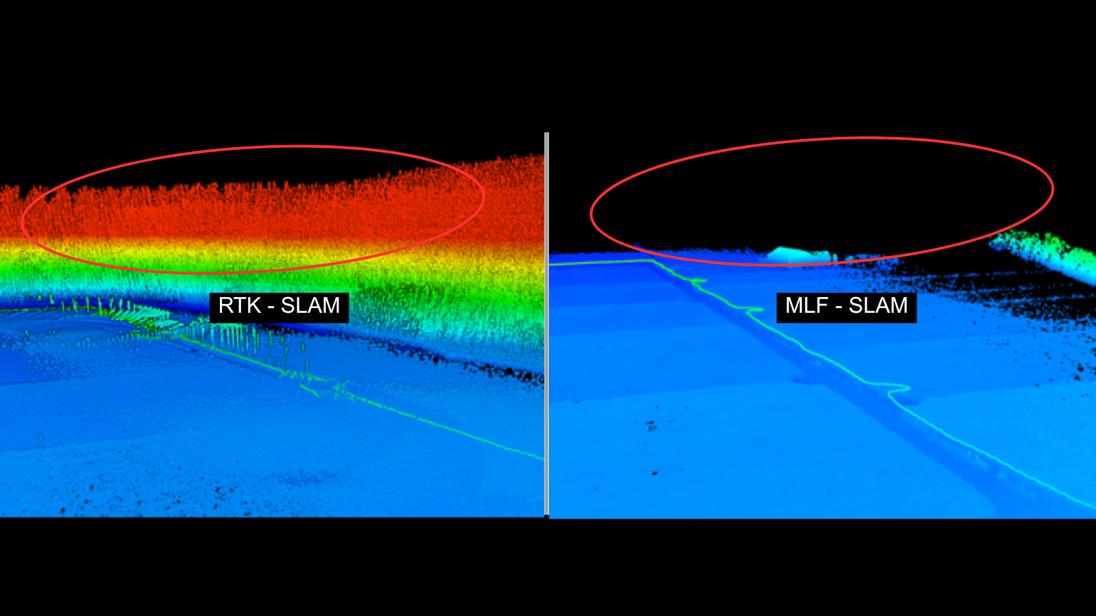
Agricultural Land


Triple-Camera Coverage for Easier and Better Capture
Front, left, and right panoramic cameras offer full 3D coverage, simplifying data capture and enhancing coloring and 3DGS quality.
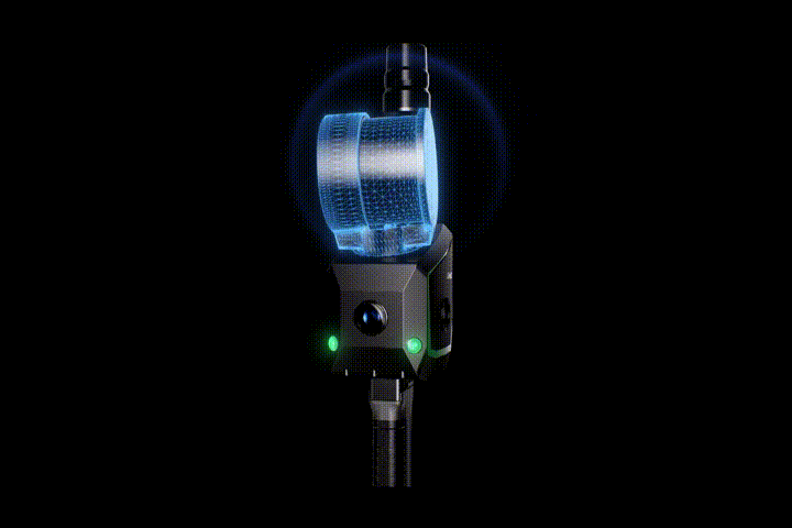
Dual-Camera VSLAM for Wider and More Stable Mapping
Dual 1.3 MP cameras cover the full LiDAR range, improving stability in low-feature areas like tunnels and underground spaces.
- Powered by GVI’s self-developed multi-sensor fusion SLAM technology
- Ensures 3 cm absolute accuracy and 2 cm repeatability—regardless of operator, environment, path, or time.
Survey-Grade Accuracy

Millimeter-Level Point Clouds, High-Fidelity Reality Capture
Supports point cloud outputs with 2 mm spacing, delivering results comparable to terrestrial laser scanning.

- LiGrip O2 supports various positioning modes to suit different working environments.
- RTK-SLAM: Ideal for areas with RTK signal
- PPK-SLAM: Suitable for environments without RTK signal
- MLF-SLAM: Designed for low- or no-feature environments
- SLAM: Best for GNSS-denied environments
Multiple Positioning Modes for Versatile Applications
Multi-form Data Collection
In addition to Handheld form, it supports various data collection configurations, including Backpack, Frontpack, Telescopic Pole, Vehicle-Mounted and UAV-Mounted, enabling flexible adaptation to diverse customer collection scenarios.

Handheld
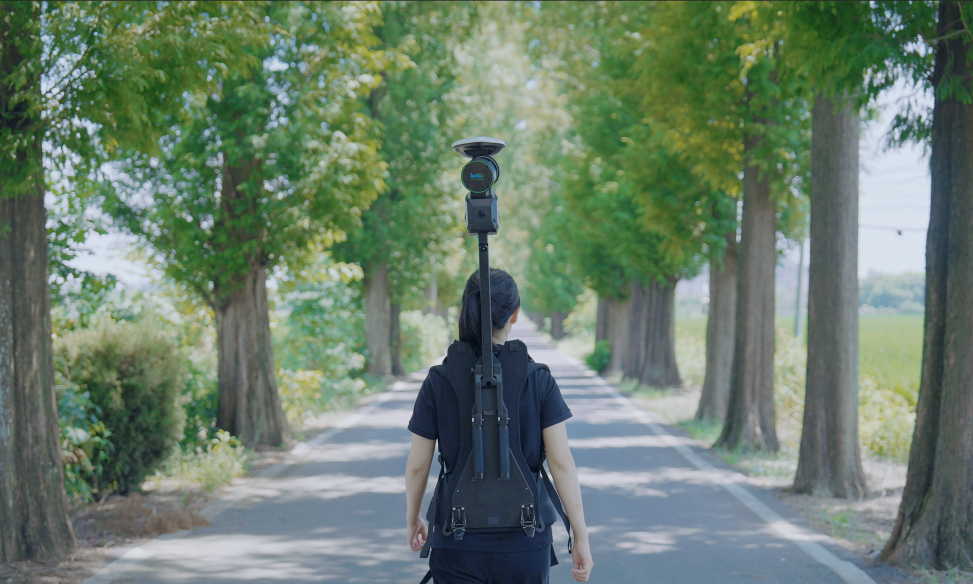
Backpack Kit

Frontpack Kit
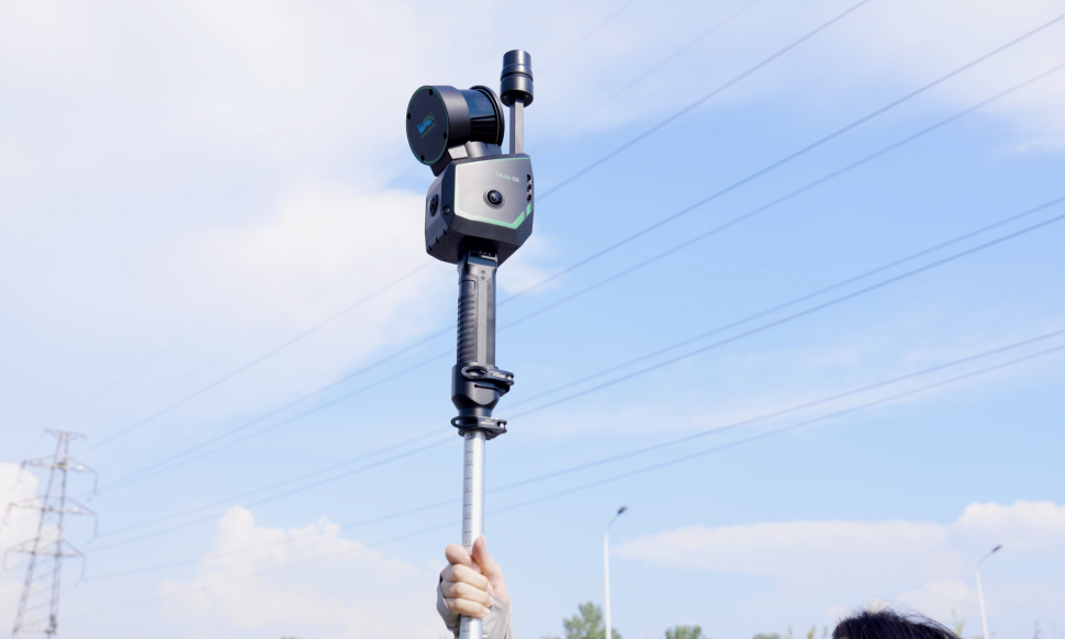
Telescopic Pole
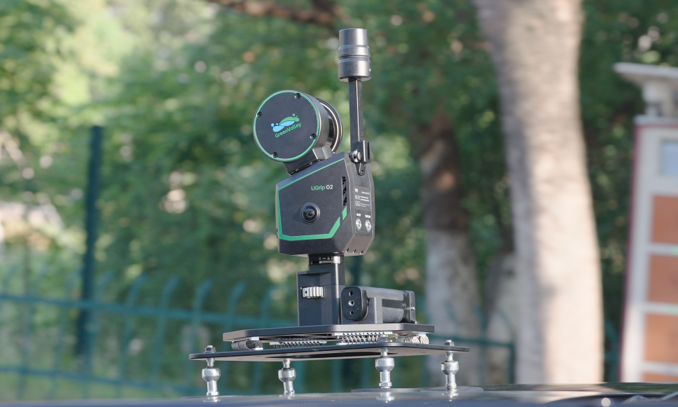
Vehicle-Mounted
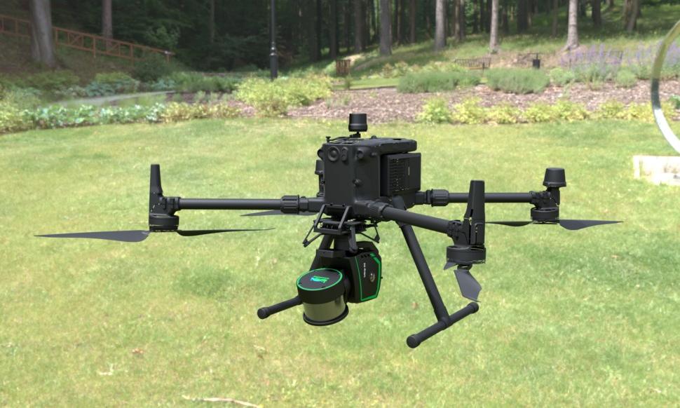
UAV-Mounted
Supporting Softwares
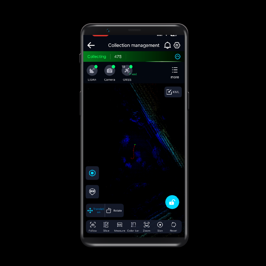 GreenValley APPLearn More
 LiDAR360MLSLearn More
 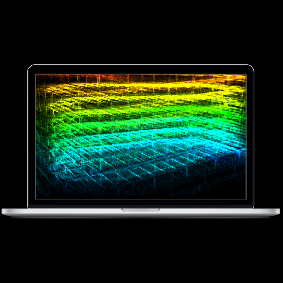 LiDAR360Learn More
 Application Scenarios
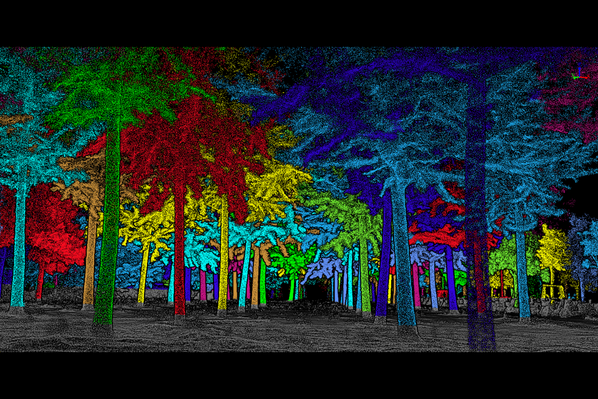 Forestry Investigation
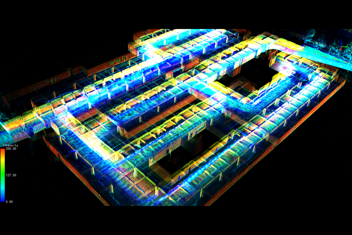 Utility Mapping
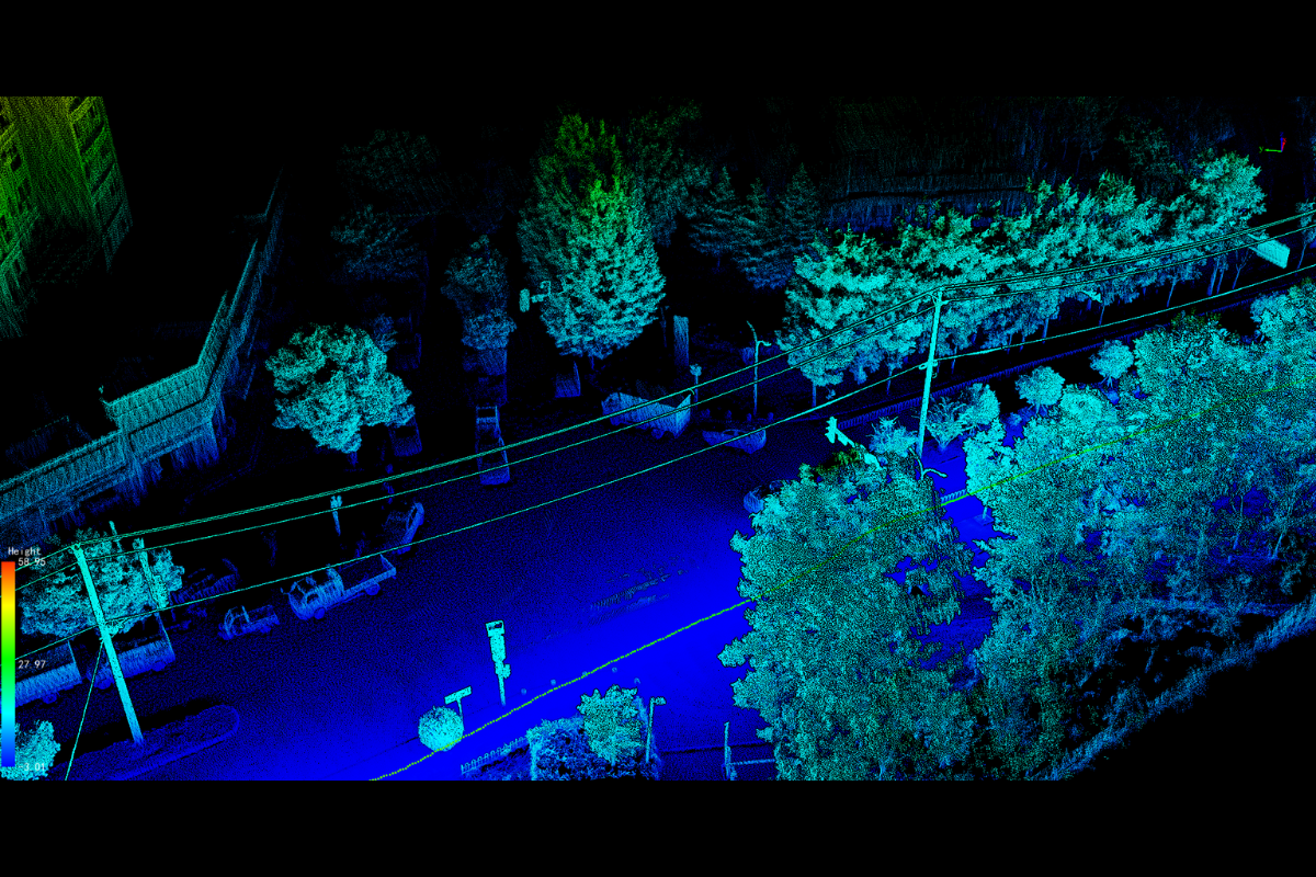 Powerline Inspection
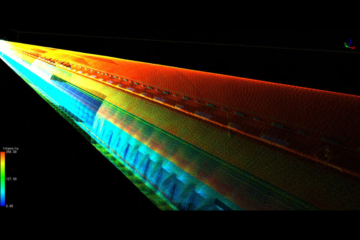 Tunnel Surveying
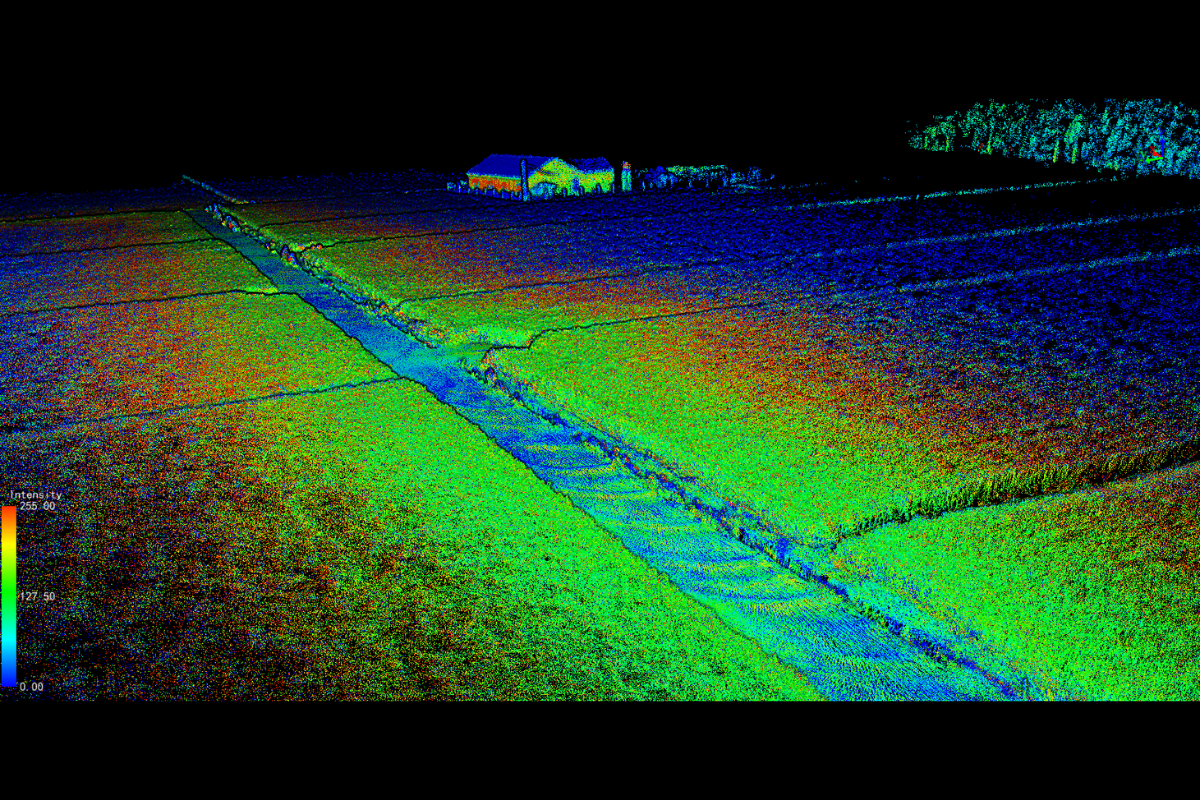 Topographic Survey
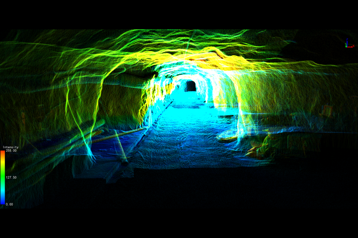 Mining
 Gaussian Splatting
 Real Estate Surveying
GreenValley International Inc (GVI), headquartered in Berkeley, California, is a leading innovator of 3D mapping technologies. GVI provides a wide range of advanced aerial, terrestrial, and mobile LiDAR survey and mapping hardware systems and cutting-edge software as well as turnkey solutions. Our portfolio includes airborne, handheld, mobile, and backpack laser scanning platforms, as well as point cloud processing software such as the LiDAR360 LiDAR data processing platform. GVI focuses on LiDAR and image fusion technology, specializing in LiDAR, UAV, SLAM, Photogrammetry, and other technologies to achieve an accurate digital representation of three-dimensional space. As we continue to expand our reach and technological capabilities, GVI remains committed to driving innovation and pushing the boundaries of what's possible in the LiDAR space.
+1(510)345-2899info@greenvalleyintl.com 729 Heinz Avenue, Suite 9, Berkeley, California 94710, USA Subscribe
Copyright © 2026 GreenValley International Inc. All Rights Reserved.
