


Scan Rate 640,000 pts/s

Scan Range up to 300 m

Laser Accuracy up to ± 1 cm

Multi-Platform Compatibility
Multiple Mapping Methods

SLAM
Point clouds with absolute coordinates can be obtained by bringing in GCP control points (if point clouds with absolute coordinates are not required, they can be directly collected).

RTK-SLAM
Suitable for areas with CORS signals, it allows you to directly obtain accurate point clouds with absolute coordinates.[In some regions, this feature is not available, please consult your local sales or partners for details]

PPK-SLAM
Point clouds with absolute coordinates can be obtained by bringing in GCP control points (if point clouds with absolute coordinates are not required, they can be directly collected).

300m ranging 640,000 pts/s

1-inch CMOS camera
Supports 6K images and high performs in indoor and low-light environments
Processing Software
 GreenValley APP
 LiDAR 360
 LiDAR 360 MLS
Multi-platform
The H300 enhances data collection flexibility and efficiency with its support for handheld, backpack, vehicle, and aerial platforms.
 Backpack
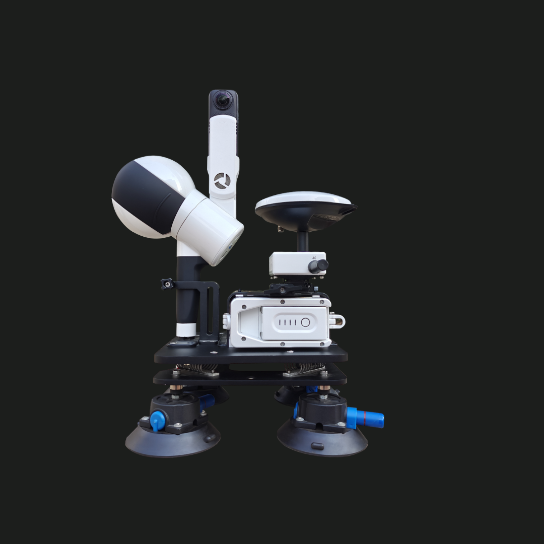 Vehicle Onboard
 Airborne Mode
Recommend Industry
 ForestryLearn More
 Power LineLearn More
  TerrainLearn More
  MiningLearn More
  UtilitiesLearn More
  HD MapsLearn More
 GreenValley International Inc (GVI), headquartered in Berkeley, California, is a leading innovator of 3D mapping technologies. GVI provides a wide range of advanced aerial, terrestrial, and mobile LiDAR survey and mapping hardware systems and cutting-edge software as well as turnkey solutions. Our portfolio includes airborne, handheld, mobile, and backpack laser scanning platforms, as well as point cloud processing software such as the LiDAR360 LiDAR data processing platform. GVI focuses on LiDAR and image fusion technology, specializing in LiDAR, UAV, SLAM, Photogrammetry, and other technologies to achieve an accurate digital representation of three-dimensional space. As we continue to expand our reach and technological capabilities, GVI remains committed to driving innovation and pushing the boundaries of what's possible in the LiDAR space.
